ShagowAskee protects the wood buffalo with an eye in the sky
Working with Sogeti, ShagowAskee utilizes a Geo Satellite Intelligence and AI solution to visualize and analyze the effects of logging and wildfires on local habitats and wildlife in Northern Alberta, Canada.
Client: ShagowAskee Foundation
Region: North America
Industry: Non-profit
Offer: Geo Satellite Intelligence and AI solution
Client Challenge
ShagowAskee wanted to use digital technology and indigenous knowledge to protect a culturally significant, genetically unique, herd of endangered wood buffalo as well as their habitats.
Solution
The organization worked with Sogeti to utilize a combination of AI, Geographical Information Systems (GIS) technology, and the Geo Satellite Intelligence (GSI) solution, which mapped the target landscape and tracked logging and wildfire activity stretching back to the 1980s.
Benefits
- Rapid analysis of vast forest landscapes using imagery
- Clearer demonstration of impact of logging on local habitats and species
- More thorough evidence in support of environmental protection policies
- Technology used to support what indigenous knowledge keepers have been saying
As companies around the world and society at large continue to reckon with the impact of business operations on the environment, clarifying the exact effect has become a significant challenge. To find a proper balance and ensure that cherished habitats are protected, technological innovation must work in unity with and support human willpower to find new solutions that bring together indigenous and modern knowledge.
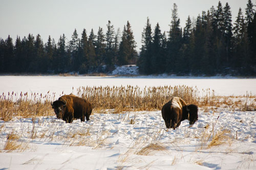
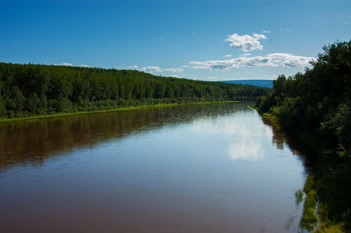 ShagowAskee, a group of indigenous elders, knowledge keepers, and trappers from Northern Alberta, Canada, understands this challenge and has set out to address it. In particular, the group is focused on protecting a culturally significant, endangered, genetically unique, herd of wood buffalo as part of its general effort to reconcile the relationship between mankind and nature. As the non-profit organization strives to defend local habitats, sustain indigenous knowledge and ways of life, and protect biodiversity within the context of modern society, it needs new technology tools to make its argument more effectively.
“It’s one thing to talk about how much logging and other business practices are impacting the land and the wood buffalo herd that lives there,” says Sugu Thuraisamy, Managing Director at ShagowAskee.
“But it’s quite another to be able to visualize and quantify the effects on a specific habitat. And without doing so, the case for serious policy and on-the-ground changes becomes much less tangible. We want to give policy makers, operators, and communities clear evidence of how these habitats have changed over time and how they’re continuing to transform today.”
In seeking to further its mission and expand its options for communicating how modern practices have impacted habitats and biodiversity in Canada, ShagowAskee turned to AI, data, and analytics to provide a new approach. However, while the organization possessed extensive knowledge that could contribute to such an endeavor, it did not have a background in the required technologies. To address this concern, ShagowAskee contacted Sogeti.
“It was a really ideal match, because we’ve got a ton of experience working with the kind of technology that could help them make their case,” explains Marcus Norrgren, Data and AI lead at Sogeti Sweden. “And they brought the vision and the drive to actually build a direct connection between that technology and support for biodiversity.”
Getting a bird’s eye view
Once the partnership began, ShagowAskee and Sogeti wasted no time before looking for a solution that would fit the project. After a review of the various options, the partners settled on Geographical Information Systems (GIS) technology and Geo Satellite Intelligence (GSI), which would apply AI and data to analyze satellite imagery in order to identify damage done to local vegetation and species by business activity and wildfires in the area. In combination with open datasets, these images provided an overall summary of the cumulative impact on the landscape and habitats of vital animals such as the wood buffalo.
"It was exactly what we were looking for: a way for technology to illustrate indigenous insight by visually articulating what is happening on the land in Canada. ” Thuraisamy describes. “With GSI, we can much more easily support the facts with evidence going back to the 80s that shows how badly we need to improve environmental practices and policy.”
 With a solution chosen and success clearly defined, the project team began a custom delivery of a readymade solution and collated multiple data sources, which enabled habitats to be thoroughly profiled. With GSI and its partnership with Sogeti, ShagowAskee gained access to a diverse collection of tools, scripts, pre- and post-processing, and AI models that could track the progress of ongoing logging and the severity of change to the land base over time. Supported by Amazon Web Services (AWS) Simple Storage Service, otherwise known as S3, and Sentinel imagery, the solution quickly assembled this data so that the forests in questions could be rapidly and repeatedly analyzed.
“This was all about putting together a visual description of what we know has been happening for decades now,” says Thuraisamy. “Being able to point to images, data, and even a movie was incredibly helpful. All of it contributed to the story we needed to tell people and policy makers in order to achieve meaningful change.”
Protecting the present for future generations
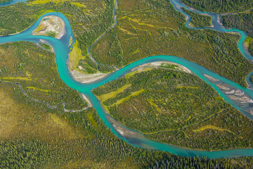 Using GSI, ShagowAskee was able to illustrate the cumulative impacts of wildfires and logging on the land since the 1980s. This demonstration clarified the ways in which business in combination with the greater intensity of natural disturbances due to climate change can alter landscapes, damage ecosystems, and impact species, such as wood buffalo. ShagowAskee can now show what was logged and where, which it can then use to demonstrate the immediate and knock-on effects of such activity.
Of course, GSI doesn’t represent the end of ShagowAskee’s efforts to preserve and restore the land and indigenous history and culture. Using all this information, the organization can now more clearly communicate with provincial and community leaders to influence practices and policy to achieve a greater balance between human and environmental needs.
“This is just a step in a process to improve practices that will restore the land and the wood buffalo herd, and keep the history attached to both alive,” explains Thuraisamy. “We need to integrate forest management, wildland wildfire management, and indigenous knowledge to put into practice the spirit and intent of existing policies and legislation which protects biodiversity and indigenous rights. With clearer visual evidence, we hope to see tangible empathetic change so that eventually balance on the land is achieved.”
“We acknowledge the many First Nations, Métis and Inuit who have lived in and cared for the Land for generations. We are grateful for the traditional Knowledge Keepers and Elders who are still with us today and those who have gone before us. Thank you to everyone for working together to protect what we cherish most and helping echo our voice to the world."
ShagowAskee Foundation
Geo-satellite Intelligence
Curious about the transformative power on what AI can do with data for your business?
Geo-satellite Intelligence
Curious about the transformative power on what AI can do with data for your business?
